S-scan

High-resolution visualization

Read our brochure


test

    OVERVIEW

    S-scan

    S-scan, Sercel’s new and innovative solution, has been designed for demanding customers who want to identify and monitor anomalies and changes in near-surface, underlying subsoil to detect and anticipate deformation and collapse (cavities, sinkholes, subsidence or landslide). It’s a full geophysical solution comprising survey design, acquisition solutions and processing to deliver results to the asset owner.

    High-resolution visualization and analysis for characterization of near-surface variability.

    Geophyscal Engineering Monitoring

    Highlights

    Geophyscal Engineering Monitoring


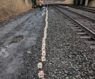
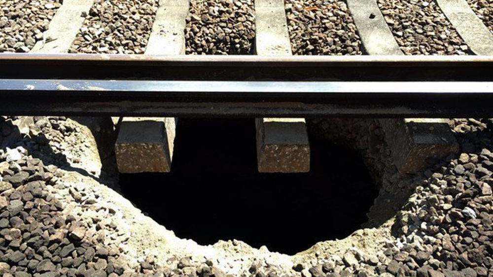
    This new S-scan solution is used for passive near-surface imaging and monitoring solution dedicated to the avoidance of deformation and collapse.

    • S-scan can help to improve Safety of travelers and workers by anticipating well in advance instabilities.
    • S-scan allows to anticipate maintenance and optimize the operations costs. 
    • S-scan optimizes and accurately determines more efficiently drilling points
    • With S-scan, it’s possible to deploy quickly a large quantity of sensors 
       

    Key Benefits

    HIGH RESOLUTION THAN CONVENTIONAL METHODS

    • Reduction of remedial maintenance costs by precise positioning of geotechnical borings.

    CHARACTERIZATION OF NEAR SURFACE AVAILABILITY

    • Safety of rail passengers and workers.

    EASE OF INSTALLATION

    • Baseline or long-term monitoring with installation time considerably reduced.
    Geophyscal Engineering Monitoring

    Download

    Category Name Language Publication Size Download
    Brochure S-scan Brochure (EN) English Jul 18, 2023 365.31 KB pdf